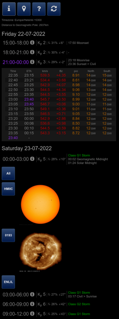
NASA makes a large amout of information available which is extremely helpful in better understanding the chanses to see Northern Lights. This information is available in many different sources and formats. I have crated a website that captures the essential values that I use when chasing the Northern Lights. The page consists of three parts:
- Location, set your own location on the map to see at what time you have “Geomagnetic Midnight”. This is when the solar wind blows from the sun, directly across the Geomagnetic Pole straight to you, allowing the Auroral Oval to stretch the furthest across the surface of the earth and appear the highest on your horizon.
- Long-term Kp forecast with moon phase and twilight times, to help you look ahead, estimate sky darkness and prepare for what might be coming the next few days.
- Nowcast, capturing satellite information with real-time metrics on the solar wind. It will help you estimate power, solarwindspeed, Bz component, protons per cubic centimeter and an estimated time of arrival on earth. Colors are used to highlight the potential intensity.
- Embedded images from NASA, highlighting images of the different origins of the solar wind for better understanding of what’s (still) coming.
- Extended Legend, explains the terminology used in the app to help you better understand what you’re looking at.